And now for something completely different (apologies to Monty Python). I posted mid-2008 a view of Lake Como as a viewpoint in Google Earth, as per caption below. Three years later a post from Ogle Earth discerned historically significant locations via Google Earth. So I decided to try the same for a family quandary.
 |
| Lago Como from top of Funicular, Google Earth as real view hazed over completely |
In my flickr! album Remembering65Nepal of some of my late Dad's slides, there are pictures of Himalayan skylines, and we were taken not far from Kathmandu to a foothills village to see Mt Everest in the distance. But where? I used Google Earth to do the following:
- "land" atop Everest and look to the SW distance toward Kathmandu
 |
click to enlarge
|
- pinpoint a ridge in middle distance that had a road, a village and a hotel
 |
click to enlarge
|
- find a hilltop nearby from which Everest can be seen - voila! a skyline not unlike what I remembered
 |
click to enlarge
|
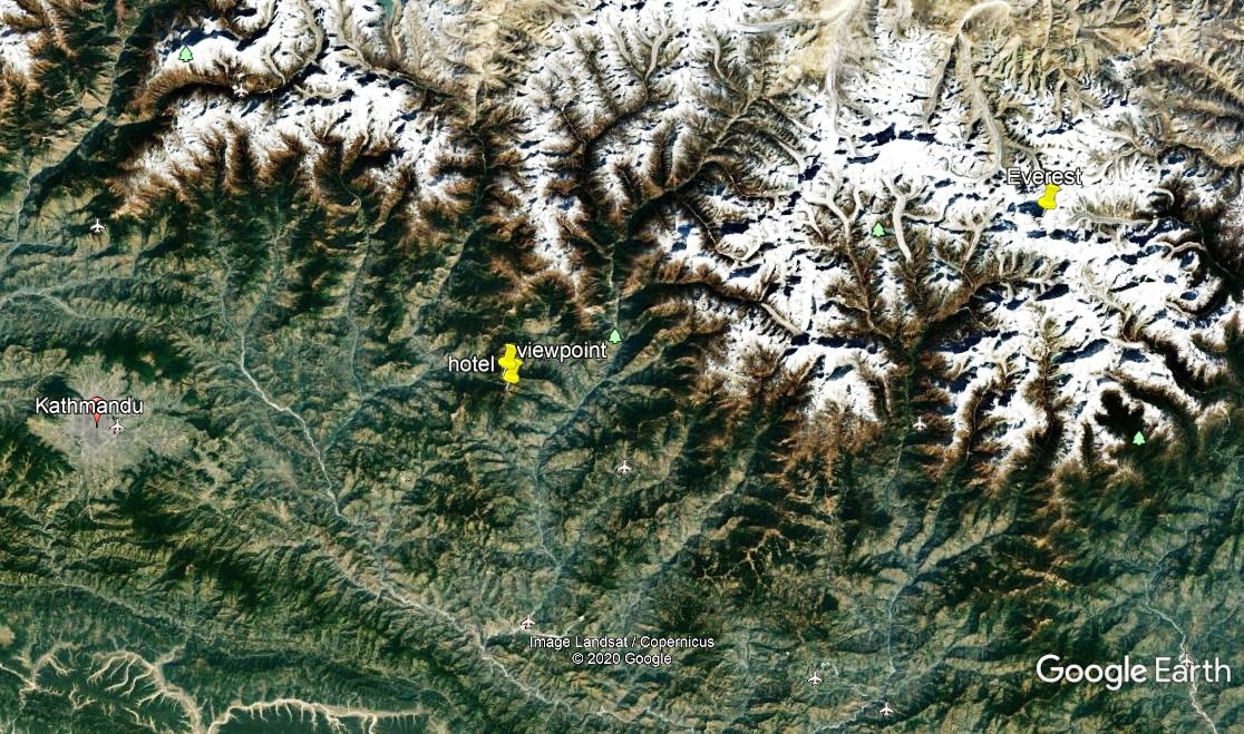
- pinpoint them on a map to see if locations make sense distance-wise
 |
| click to enlarge |
- measure the approximate road distance to the village, and as-the-crow-flies distance to Everest
 |
| click to enlarge |
All this appears to make sense, so that location is a good candidate, although not necessarily exact. But it restores for the family a viewpoint that we held dear.
The proper way would be to do view-shed analysis in a GIS, but collecting the topography, and posting it in 3D to process makes it onerous. And Google Earth made is so easy if approximate, that even my family got the GISt of it...


No comments:
Post a Comment
Thanks for reading! Please share in Comments your questions & stories...