The #30DayMapChallenge Day 23 challenge is "GHSL data", here is the section in the story map that will chronicle the map challenge when it's finished:
Global Human Settlement for Northstowe controversial development NW of Cambridge UK, monitoring housing probability (GHS-BUILT-S2, 2018) and housing footprint (GHSL-ESM, 2015) against Esri 2020 Land Cover map extract with OpenStreetMap detailed base-map. Various blended overlays 'bake' the layers into a screen pattern allowing to compare and contrast past built areas vs. currently probably built against submissions.
Liner notes
 |
| click to enlarge, or see full size |
- Housing probability "map of built-up areas expressed in terms of a probability grid at 10 m spatial resolution derived from a Sentinel-2 global image composite" for 2018 in Soft Light overlay blend
- Housing footprint, "built-up areas classification at a spatial resolution of 2 meters", shows building footprints for 2015 in Multiply overlay blend
- Land cover in Overlay layer blend, to help see the underlying details
- OpenStreetMap base map gives the infrastructure details that are reportedly quite current
Backstory
I first posted on this topic 5½ years ago, and concluded then that housing development was likely not on a flood plain based on the maps examined. As mentioned however, increased flooding was already an issue then, and that came back when a local activist picked up my Day 8 map challenge (wait for twitter image):
#30DayMapChallenge oops skipped Day 8: Blue
— Andrew Zolnai (@azolnai) November 10, 2021
Current flood defenses as they relate to future sea level rise model in King Lynn, coastal East Anglia UK, from DEFRA AIMS dataset corrected (slide 7 in https://t.co/RmrkNzbOGL) pic.twitter.com/I7DCG1T7CD
The issue was that developers were reshaping the lands in the curve of the guided busway... coincidentally at the red dot below, the area of concern way back then! As I'm also member of a Flood Watch Group with the local Parish Council, I connected said activist with an Internal Drainage Board contact who was able to investigate if planning permissions were being respected.
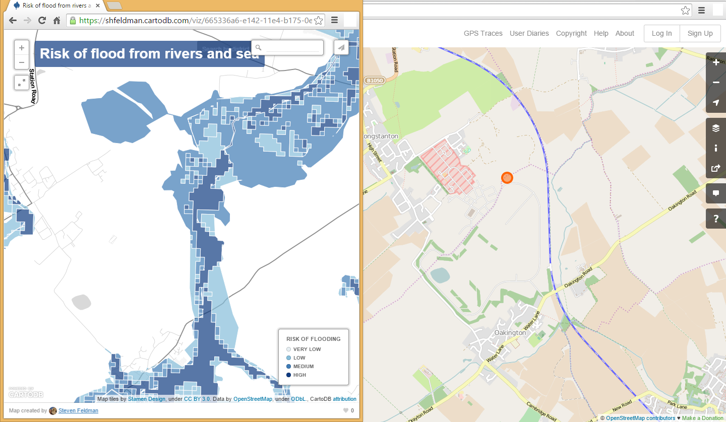 |
| from original blog post |
No comments:
Post a Comment
Thanks for reading! Please share in Comments your questions & stories...