... said Caïus, "this young noble went charging by in his chariot, but 20 milia north between the tumulus and the circular fort ruins, I had to retrieve him from the bushes... His chariots had crashed going straight and missing the jog in the road". "Jog in the road?" asks Severus. "Yes", replies Caïus, "the road is misaligned NW and SW at that point, and there's a 20 pedes section at a sharp angle joining them". "How odd" retorts Severus, "We build perfect roads... why that misalignment? Did the Gods have fun and push them aside to catch speeding charioteers? Surely the indigenous, if there are any, couldn't sabotage a road: they barely build huts of reeds, never mind challenging our glorious engineering... Ave, Caesar!", he salutes, "I must go." [Click images to enlarge]
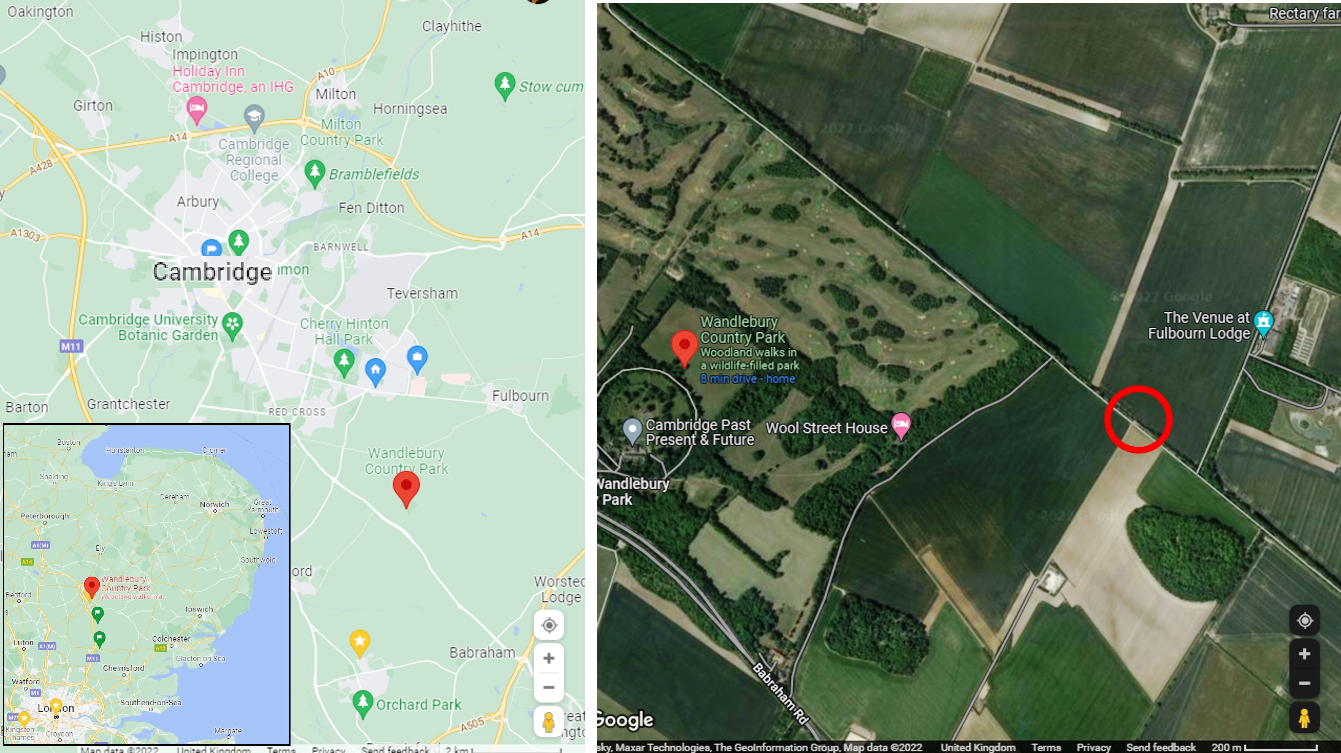 |
| Location map, follow the red Google markers |
So where are we? We're halfway between London and the North Sea, in East Anglia known for its Iron Age forts and dykes and its Roman Roads - see also maps here - the satellite imagery above clearly shows the Roman Road cutting a straight line NW - SE in this particular area. The red circle is the spot in question, with the "fort ruins" known today as Wandlebury Iron Age Hill Fort at centre left of the picture above, and the tumulus called Copley Tumulus now the bean shaped wooded area a little below and to the right of the circle.
 |
| Looking SE along Roman Road, walking fron Wandelbury hillfort toward Copley tumulus |
This is what it looks like walking along the Roman Road. You'd hardly notice it, except that in my 8 yrs high school Latin and classic history, and later work with surveyors in GIS, I had heard what I took for an urban legend about route misalignments for cross-country projects like Roman Roads - the most famous being a pipeline built from both ends to save time, ended up being 30' apart at planned junction, so were simply twinned continuing parallel to finished sections! - but that likely urban legend is the clue to this situation here: Romans could carry road building materials around the East Anglia coast to the Wash somewhere near current Kings Lynn, so they could start building south from there. Likewise the other section may have been built starting from current London Docks northward (see also Edward Rutherfurd's "London", Crown Publishers, 1997, for couleur locale). And while Romans were skilled engineers and survyors, it could be that over 50+ miles they mis-surveyed by 10+ feet at the junction point we're looking at. Et voila! the jog the poor charioteer missed and crashed into the bushes (that definitely is an urban legend LOL).
 |
| Google Earth view looking SE of same locale |
When I shared this picture, a GIS friend suggested a drone be flown to reconnoitre the area... That made me wonder: would Google Earth provide enough detail and a perspective view on this jog? It is not mapped on Ordnance Survey App I have on my phone I used to guide me on my walk (see below). The jog is clearly visible in the pespective view above - see it in your browser here, no app required - even if it's obscured by modern roadworks - later reworking is the scourge of historians and archaeologists!
 |
| OS Maps App of area, contains OS Data (c) Crown Copyright 2022 |
No comments:
Post a Comment
Thanks for reading! Please share in Comments your questions & stories...