Cinema appears however to evolve the opposite way, increasing from classic 2D to high definition and 3D on ever larger screens. The array of hardware and avatars illustrated in that movie is impressive, but how applicable is it in today's world? All the CGI in the world will not geolocate a scene in this movie

(a reported 47 min. for every frame over a 160 min movie, makes 144000 frames and 12 man years to render...)
(screenshot from Film blog on Avatar film formats)
The answer is perhaps not to do 3D just because we can - who needs to plaster graffiti on Streetview in Wild Style City, really? - but to do it when it is useful.

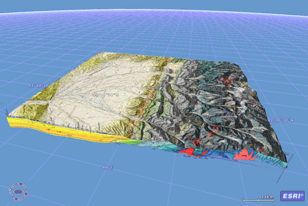
Whilst adding 3D buildings and texture mapping are well covered in Google Earth and Bing Maps, subsurface 3D important to natural resources is rare in webmaps. Exprodat's Chris Jepps posted a blog on cross-sections in ArcGIS Explorer.

And Gerardo Paz has an oil rig model in KMZ in Google Earth blog.

Whilst adding 3D buildings and texture mapping are well covered in Google Earth and Bing Maps, subsurface 3D important to natural resources is rare in webmaps. Exprodat's Chris Jepps posted a blog on cross-sections in ArcGIS Explorer.
And Gerardo Paz has an oil rig model in KMZ in Google Earth blog.

I cannot end this post on the eve of Christmas Eve without mentioning NORAD Tracks Santa!

Ho! Ho! Ho!

No comments:
Post a Comment
Please send me a copy of your prospectus to