[
Update: this was summarised into a story map here posted also on this blog here]
Two years then
one year ago I QC'd UK Ordnance Survey data for East Anglia, and sent the polyline spike and kickback errors to the Agency, who posted the corrections this year. They noted the errors I reported fell below their own QC criteria, but they invited me to retest their updated dataset. This issue is topical as
posted on GISlounge on the same topic proposing other tools.
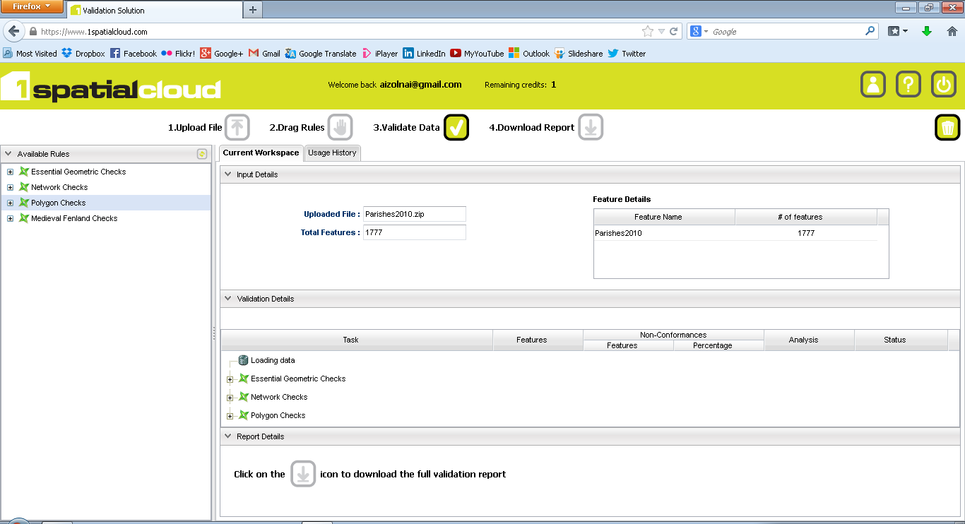
1SpatialCloud work on a fremium basis, but since I tested their predecessor Socium, they kindly let me re-test both old and new datasets in their new web tools. I first tested for geometric, network and polygon checks on May 2010 Ordnance Survey Boundary Line polygons for Parish boundaries:
 |
| click to enlarge |
If results were very good in 2010, with 25 errors out of 1777 polygons...
 |
| Click to enlarge |
...they were even better in the 2013 update at only 1 spike out of 1779 polygons!
 |
| click to enlarge |
And how to better illustrate this clean-up than on the map posted on
Arcgis Online (updated)?
 |
| click to enlarge |
Again, making public data available does help spur on data improvements, and online data validation helps identify errors quickly and efficiently. This makes it easier for the public to communicate, and for data custodians to high-grade their holdings.


No comments:
Post a Comment
Thanks for reading! Please share in Comments your questions & stories...