Not only was Roger Tomlinson a delightful companion to a few Russian meetings in Moscow and Tyumen about five years ago with ESRI (see travelog image atop my blog), but as a Canadian geomatician myself I kind of grandfathered him (little did I know I'd end up near his birthplace soon after). I myself started GIS in the resources sector in 1986, and in those days you sought any help that was far and few between indeed, and you guessed that he was among them (his brief history in here and here). To see what GIS looked like in 1967, skip to the third video:
Resources issues
Computer mapping
Early GIS
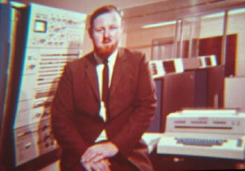
These YouTube videos are "A look at the Canada Land Inventory Geo-Information System, a computer system used to help manage and develop Canadian land". The issues feature in the first video with Tomlison himself appearing at the end, the processes in the second video and the GIS system itself in the third.
These are intriguing videos in that it shows what departmental GIS:
These are intriguing videos in that it shows what departmental GIS:
- looked like over forty years ago - video terminals, teletype, punchcards, female clerks and male techs & managers etc.
- were set out to do right at the begining - to integrate land use, finance and demographic data, thus allowing to query real-world business and geographic scenarios
- intended to educate the public of all that is invloved in this, and in plain if long-winded language, complete with Telstar-like space sound effects!
No comments:
Post a Comment
Thanks for reading! Please share in Comments your questions & stories...